

The Osh Region is bounded by (clockwise) Jalal-Abad Region, Naryn Region, Xinjiang, China, Tajikistan, Batken Region, and Uzbekistan. More than half of all Kyrgyzstan’s Uzbeks live in Osh Region. and represented 28% of the Osh Region’s population of one million (excludes city of Osh) according to the 2009 census.
The city of Osh (see my post for attractions in town) and most people in the region live in the flat northern part of the Oblast, on the edge of the Fergana Valley.
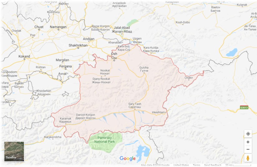
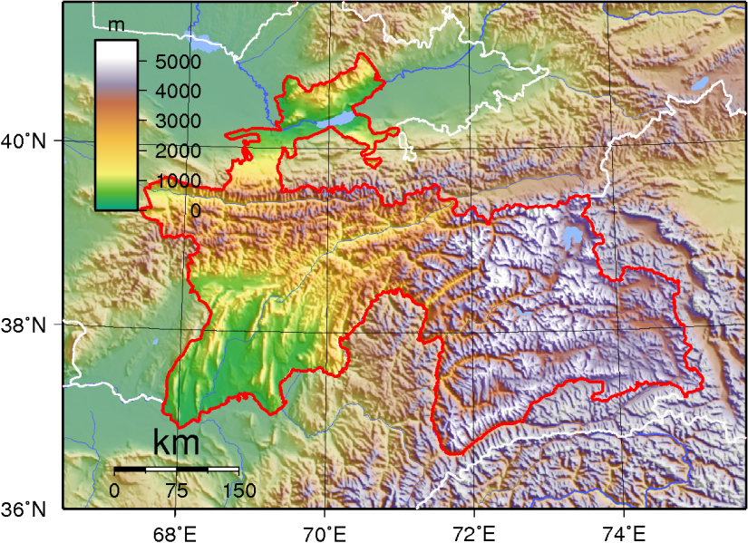
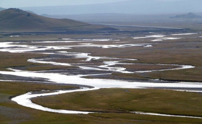
The land gradually rises southward to the crest of the Alay Mountains, drops into the Alay Valley and rises to the Trans-Alay Range which forms the border with Tajikistan. In the east, the land rises to the Fergana Range which is roughly parallel to the Naryn border. This area is drained by the Kara Darya River which flows northwest to join the Naryn River to form the Syr Darya in the Fergana Valley.

Highway M41 goes south over the mountains from Osh to the Tajik border. At Sary-Tash a branch goes east to the Chinese border crossing at Irkeshtam. The other main road goes west through the flat country to Batken Region. (See my post Osh Adventure Experience for more about these mountains.)
Osh Region on the Silk Road


Perched in the mountains at the end of the Fergana Valley, on the border with Uzbekistan, Osh is one of the Silk Roads’ oldest and most famous market towns and is Kyrgyzstan’s most ancient city – dating back some 3,000 years. The city’s historical success a center of trade can, in part, be explained by its position along Kyrgyzstan’s borders with Uzbekistan and Tajikistan: a border that is largely impenetrable due to its mountainous terrain.
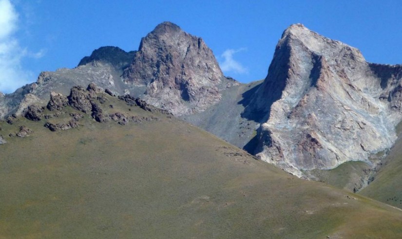
Kyzylart Pass is a mountain pass and border crossing in the Trans-Alay Range on the border of Tajikistan and Kyrgyzstan. The Pamir Mountains, or the Pamirs, are at the junction of the Himalayas with the Tian Shan, Karakoram, Kunlun, Hindu Kush, Suleman and Hindu Raj ranges. They are among the world’s highest mountains.
For traders along the Silk Roads, Osh was a crossroads and an important center of of production in its own right. Osh is an oasis at the end of a long drive through the Fergana Valley; a chance to rest, resupply and immerse yourself in this multicultural traveler’s haven.
Heralded as a charmed and cultured place, rich in fruit and nut forests, Osh flourished during the most prosperous periods of the Silk Road
Irkeshtam Pass – Old Gateway to China
Irkesthtam (Erkeshtam) is one of two border crossings between Kyrgyzstan and China, the other being the Torugart Pass in Naryn Region which lies some 165 km (103 mi) northeast abd replaced Irkeshtam as the primary overland link between Xinjiang and the then-Soviet Kyrgyz Republic. Irkeshtam is the westernmost border crossing in China. The overland travel distance from Erekshtam to Osh is 210 km (130 mi), about 800 km (500 mi) shorter than via the Torugart Border Crossing in Naryn Region.
For details on how to cross the Irkeshtam Pass Border from China into Kyrgyzstan (or the other way, though some things may be different in that direction) see this post prepared by Silk Road Hitchhiker , which gives a chronology of a border crossing.
Kyzylart Pass – Gateway to Tajikistan
Sary Tash is a major crossroad, if you’re about to pass the Kyzylart Pass, it’s a good idea to spend a night there to accustom yourself to the high altitude (Sary Tash is 3170 metres above sea level).
Although this remote village has only some shop-cafes, a petrol station and five guest houses. it is an important road junction connecting China, Kyrgyzstan and Tajikistan. Its name is derived from Turkic roots and means “yellow-stone”
Kyzylart Pass is a mountain pass and border crossing in the Trans-Alay Range on the border of Tajikistan and Kyrgyzstan. The highest point is 4,280 m (14,042 ft). Throughout the area, the land is typically rugged and dry. It is crossed by the Pamir Highway which leads south from Sary-Tash in the Alay Valley up onto the Pamir plateau toward Karakol Lake and Murghab,Tajikistan. In the late nineteenth century the Russians explored and eventually occupy the Pamir plateau.
The Pamir Mountains, or the Pamirs, are at the junction of the Himalayas with the Tian Shan, Karakoram, Kunlun, Hindu Kush, Suleman and Hindu Raj ranges. They are among the world’s highest mountains.

The precise extent of the Pamir Mountains is subject to debate. They lie mostly in the Gorno-Badakhshan province of Tajikistan. To the north they join the Tian Shan mountains along the Alay Valley. To the south they border the Hindu Kush mountains along Afghanistan’s Wakhan Corridor. To the east they are generally considered to extend to the range that includes China’s Kongur Tagh,


Kara Suu
The Karasuu Bazaar in the Kyrgyz town of Kara-Suu is a highly important center of import of Chinese consumer goods into Southern Kyrgyzstan, Uzbekistan and Tajikistan, comparable with the Dordoy Bazaar in Bishkek (which targets Northern Kyrgyzstan, Kazakh and Russian markets)
Things to See in Osh Province
Abshir Ata Falls
The falls are unique and cool to see in that they come out of a rocky hill, they they are not especially tall. If you plan on getting to the fall by yourself, go to the taxi stand in front of the Osh City Philharmonia. The two hour drive to the fall is beautiful and interesting; traveling through several villages. There is a run down to three little spots where locals sell souvenirs . If you walk beyond the fall (and have more time to spend take a few hours to trek through the beautiful park to get some great photos).


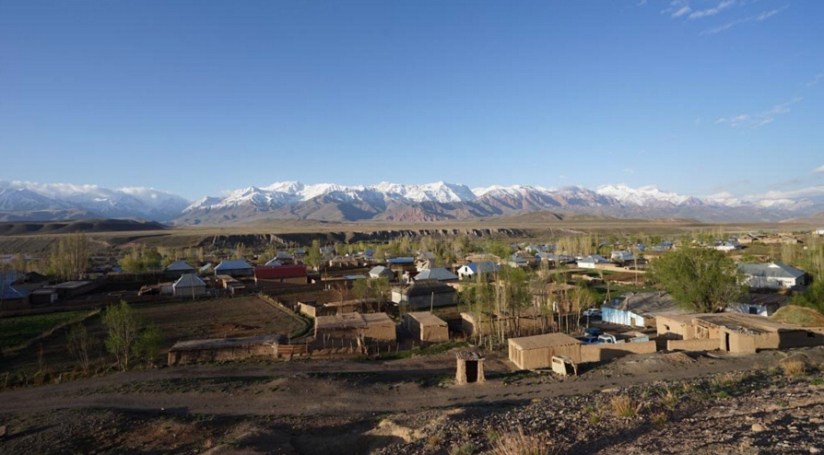
Alay Valley
The Alay Valley is an easy drive south of Osh. It is wild, rugged, peaceful and awesome and a place that sadly very few tourists venture. The Alay Valley has lovely nature and lots of opportunities for hiking or just generally enjoying the fantastic views of the mountains.
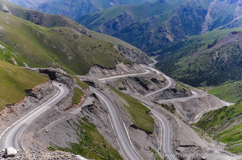
The road is newly reconstructed with Chinese grant money. The reward for the drive is fantastic scenery enroute! A compulsory photo-stop is near the top of the Taldyk Pass & look downhill at the serpentine road that you just climbed!
There are CBT and other B&B accommodations available in various villages in the Alay valley (e.g. Sary Mogul, Sary Tash, Daroot-Korgon) or even at Lenin Peak basecamp (there are tents & yurts provided by various tour operators). Do not expect 5-star facilities here – clean sheets & simple bath/toilet in the guesthouses. (See our page Tour Company Reviews for more details)
If you are not planning to proceed further into Tajikistan or China via their respective passes, then you will have to back-track to Osh. You can do it as an overnight visit or plan for several days of activities (hiking or on horseback).

The valley itself is a vast, deserted area, surrounded by two mountain ranges from north and south. It’s worth visiting mostly as a starting point of a trekking in the mountains. Although the small, dusty villages with an amazing view of Lenin Peak are very charming.
Kara Suu Bazaar
The Kara Suu Bazaar in the Kyrgyz town of Kara-Suu is a highly important center of import of Chinese consumer goods into Southern Kyrgyzstan, Uzbekistan and Tajikistan, comparable with Dordoy Bazaar in Bishkek (which targets Northern Kyrgyzstan, Kazakh and Russian markets)


Uzgen
Uzgen in an hour drive north of Osh and is a town of 50,000 capital of the Uzgen District. and is a nice stop over from Osh to Jalal-Abad It is located on the banks of the on the banks of the Kara-Darya, river at the far eastern end of the Fergana Valley, upstream of the point where the Kara-Darya enters the valley.The town is mentioned in Chinese annals of the second century BC. It was one of the capitals of the Karakhanids, who called it Mavarannahr and left three well-preserved mausolea. Uzgen became the capital of Muhammad b. Nasr when the Kara-Khanid Khanate split into two branches.
The Kara-Khanid Khanate was a Turkic dynasty that ruled in Transoxania in Central Asia, ruled by a dynasty known in literature as the Karakhanids. The dynastic name Karakhanids refers to royal titles with Kara Kağan being the most important Turkish title up till the end of the dynasty.


The Khanate conquered Transoxania and ruled it between 999–1211 during the time of Marco Polo. Their arrival in Transoxania signaled a definitive shift from Iranian to Turkic predominance in Central Asia, yet the Kara-khanids gradually assimilated the Persian-Arab Muslim culture, while retaining some of their native Turkish roots.

Their capitals included Kashgar, Balasagun, Uzgen and Samarkand. The Khanate eventually split into two – the Eastern and Western Khanates. They then came under the suzerainty of the Seljuks, followed by the Karkkhandis before the dynasty was extinguished by the Khwarezmians. Their history is reconstructed from fragmentary and often contradictory written sources, as well as studies on their coinage. (See my blog post Karkkhandis for more details)
Accounts of Uzgen were found in the works of Arab writers like Al-Muqaddasi and Ibn Hawqal in the 10th century
Uzgen Archaeological-Architectural Museum Complex
You will find a minature Taj Mahal in at the Uzgen Archaeological complex. The mausoleums are from 16th century and older, inside nothing to see but outside a beautiful facade. All three are lined up in a row included the jewel Karakhanind mausoleum from the 12th century.


The mausoleums have great architecture with some very detailed fresco work on the walls. The mausoleums are from 16th century and older, inside nothing to see but outside a beautiful facade. All three are lined up in a row.


You can climb the minarett, but watch your steps carefully in the narrow and dark spiral stair.. Ask for keys at kiosk at entrance. The view is fantastic, mountains with snow across 270 degrees of the horizon.


Walk down the road to explore the lively local bazaar to catch some refreshments. You never know what you will find.


Learn More
Uzgen Ancient Town – Destination Osh

1 thought on “Osh Region”